

K2 Base Camp Trek Summary.
The K2 Base Camp trek summary is about my journey to K2. K2 is the second-highest and most fascinating peak in the world. Trekking to the base camp of K2 is one of the most exciting and adventurous trips on the planet. The K2 base camp trek lies in the northwestern Karakoram Range. It is in The Karakoram Mountains of Gilgit–Baltistan, Pakistan. Rising steeply above the Karakoram Range along the Pakistan-China border and battered by atrocious weather, this pyramid-shaped peak has always been the ultimate challenge for the best mountaineers in the world.
K2 trek leads through a spectacular mountain wilderness, following narrow trails above the swirling Braldu River before ascending the extensive Baltoro Glacier.
However, the K2 Base Camp trek is a challenging but rewarding trek with many days on the rugged, tumbled glacier as you head up to and beyond Concordia, where the Baltoro and the Godwin-Austen glaciers converge in a beauty and simplicity of ice and rock.
The K2 Base Camp trek summary
The K2 base camp trek journey starts by arriving at Islamabad International Airport. Islamabad has a new airport. Our guide met us at the airport and then transferred us to a lovely hotel in Islamabad. Islamabad is the purpose-built green capital city of Pakistan. After spending a night in Islamabad, we took a spectacular mountain flight to Skardu.

Landing at the Skardu airport on our first attempt seemed a good omen. As we stepped off the plane, the mountains surrounding us were stunning. But nothing compared to what awaited us.
We spent two days in Skardu for preparation and documentation with the local authorities. We had a group briefing at the tourism office, where the officer briefed us about the restricted zones in the central Karakoram National Park.
What struck my foreign clients the most was how friendly everyone was. This country is often poorly portrayed in Western media as unfriendly, and teeming with Western-hating terrorists is the exact opposite. Everyone was friendly, welcoming and proud. Certainly, the Skardu and the Baltistan region proved to be so over and over. We walked freely around Skardu at all hours and never felt ill at ease. I am not aware of an unkind word or gesture toward anyone.
On June 8, the K2 base camp trek began in earnest with a 7-8 hour Jeep ride to the small village of Askole. Skardu to Askole distance is about 150 km, but the Toyota Land Cruisers were rarely above second gear and never into fourth. Parts of the route are ever-changing as the creeks, which can explode in size in a matter of hours, bring down debris, especially rocks and boulders, that need to be navigated around. Roads and bridges can suddenly disappear or be stranded.
The route initially follows the Indus River before crossing some low foothills that separate the Shigar Valley and Braldu River from the Indus until they join several kilometres downstream. The route after the village of Shigar becomes more and more breathtaking. Crossing sometimes raging streams or clinging to the side of canyon walls with the swollen, dirty Braldu moving massive boulders as it thunders towards the Indus can be exhilarating or intimidating. Our Pakistani drivers were maestros in conducting the Toyotas to their final destination of Askole.
After camp setup and other details, we visited the tiny village, including a museum that comprised one of the first homes. This village area has been inhabited for over 400 years. The original inhabitants crossed one of the high mountain passes to escape aggressors and find a peaceful homeland.
Meanwhile, the rest did our acclimatisation hike two days early. A 500-metre walk up and down a nearby mountain gave us a good workout.
On June 11, we were on the trail around 0600 hours. The weather had changed as we spent most of the day walking to Paiju Camp in intermittent showers and rain that carried over from the previous evening.
The trail gradually became more rugged, including high traverses above the Braldu and tippy-toeing along the river, a continuous ribbon of power. Another constant from the river was the rumble of large boulders being carried downstream by the power of the water. It often sounded like thunder.
An hour’s walk from the Paiju Camp brought us close to the toe of the Baltoro glacier. We would not sleep on or beside a glacier for a few more nights.
The weather began to improve, and we had more spectacular mountain vistas, including names that litter the annals of Karakoram mountaineering history, such as Paiju Peak, Atwa, the Trango and Cathedral groups, Uli Biaho Tower, Liligo Peak and more.
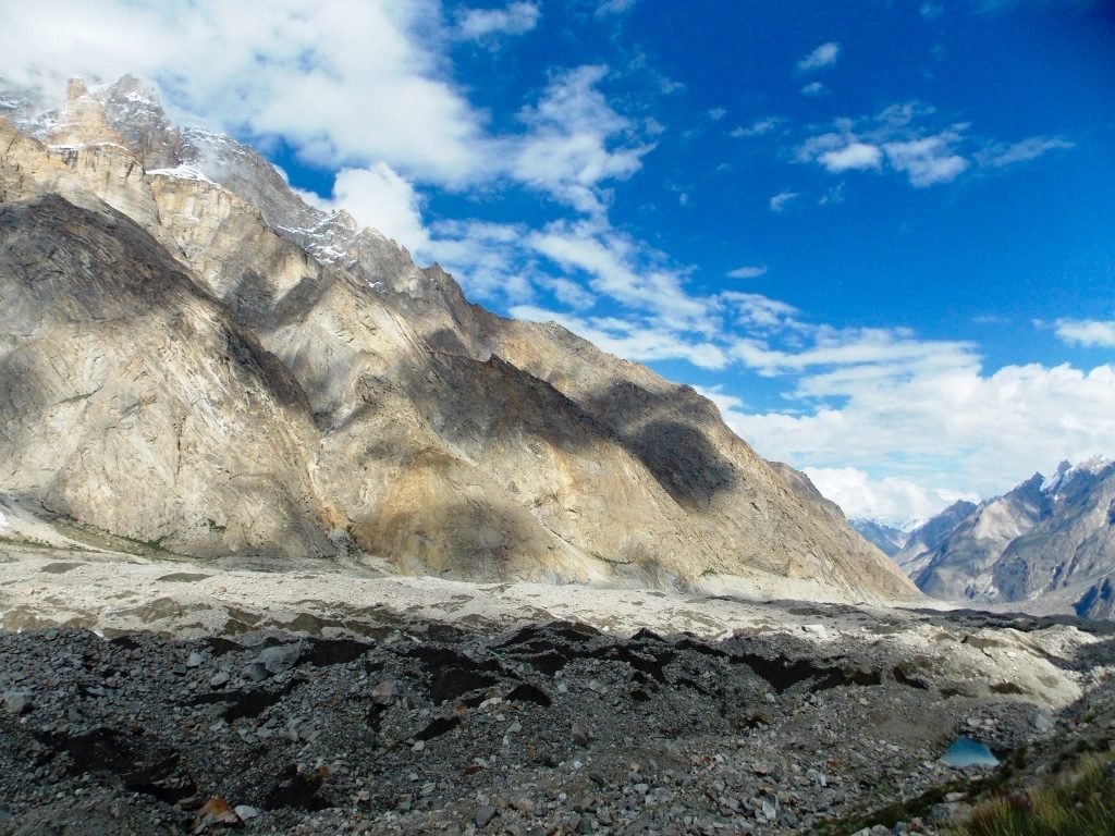
On June 12, the Baltoro glacier welcomed us this morning. Our progress slowed as the need to watch every step became not only routine but a requirement. Watching every step caused a rapid change of technique.
Traversing a glacier is like following a male dog, seemingly wandering the reality and the destination in mind. How one can arrive is never certain. Glacier travel rarely follows precisely the same route from one day to the next. It may change during the day as glacial meltwater swells with rain or sunshine, and the risk of rockfall increases with the temperature.
Baltoro is one of the most dynamic places on the planet. One can observe almost daily the Earth going through changes that form and create the landscape. In most other places, it takes thousands of years to change the landscapes, river carving away the land, cornice caving, and rocks and soil ground into powder. But with time, they become more permanent and begin the ecological succession that one day will see a meadow or a forest where today there seems to be only rock and ice.
More grand mountains revealed themselves, including the mighty Trango Tower. A spectacularly elegant and beautiful rock spire, and the scene of one of the most legendary mountain climbing achievements, when Doug Scott of Britain successfully reached the summit.
Each day, we were steadily and safely gaining altitude. Our bodies were adapting to the declining levels of oxygen. Even so, most of us found hills that we could run up at lower elevations left us breathing deeply.
Today, the weather started to turn for the better while camping at Khoburtse. Once again, in awe of the spectacular mountain views.
June 13 was a rest day, as we only walked for about 2.5 hours and gained 100 metres of elevation. Most days involved 6-8 hours and 3-400 metres of elevation gain. No more than 400 metres of elevation a day to safely acclimatise. The total elevation gain and loss far exceeded this amount as we scrambled up and down the hills and valleys, but the net amount is the critical factor to minimise the risk of Acute Mountain Sickness.
We finished the day at Udurkas Camp, having glorious views of Gasherbrum, Broad Peak and glimpses of Gasherbrum I, Mitre Peak and more. The Nameless Tower was dominant from the camp.
As we reached, we observed a beautiful cornice above our campsite. I thought having a large ridge between the camp and the base of the peak was good. And at about 2:30 am, many of us were awakened by a thunderous rumble. The next day, at least half the cornice was gone. It was the first of what would become a regular event of avalanches and landslides, letting go at all times of the day and night. Those at night seemed more ominous as you lay in your tent with nothing to do but listen and hope it stops or misses.
June 14, we trudged up the Baltoro glacier and on to Concordia, another legendary site sitting at the foot of Gasherbrum IV. It is the confluence of the Baltoro, Concordia and Godwin-Austen glaciers. Here, facing Gasherbrum IV, a right turn leads to the basecamp for Gasherbrum I and Gasherbrum II. A left turn from Broad Peak base camp takes you to the K2 base camp, the greatest concentration of 8,000-metre peaks. It truly is the “Throne Room of the Mountain Gods”.
On the way, we also passed Masherbrum peak, also called the Queen of the Karakoram and was initially believed to be the highest of the Karakoram peaks. It was designated K1 by Thomas Montgomerie of the Great Trigonometric Survey of British India when he first saw this peak as he approached it from Hushe. Hushe is located in a valley South and was our final trekking destination. We had also passed the Young Husband glacier on our left with the Mustagh Tower. This route takes you to the North side of K2.
We spent the rest of the day marvelling at the spectacular scenery and depleting our retinue of superlatives. K2, meanwhile, kept a steady vigil at the head of the Godwin-Austen glacier. It seemed we were continually checking to confirm this natural miracle was still there every few minutes.

The Concordia glacier is a large piece of ice outside the polar region and certainly one of the coldest places to sleep. Several hundred feet of ice, an elevation of 4,500 metres and an almost constant wind all contribute. A high-quality sleeping bag is essential for this trekking holiday.
K2 base camp at 5,150 metres is substantially colder, which would cause our support team to be exceptionally uncomfortable. Our porters, like most porters or Sherpas around the world, rely on the seasonal work provided by adventure trekkers or mountaineering expeditions for the income to support them and their families for the entire year. The tourism industry in Pakistan has been hit hard over the past 15 years since 9/11.
Unfortunately, the Western media continues to focus on the negativity and cast widespread misperceptions about Pakistan and the Pakistani people. There is no question that there are Taliban and other unsavoury factions in Pakistan, but they are in the vast minority. No one wants them gone more than most of the citizens of Pakistan.
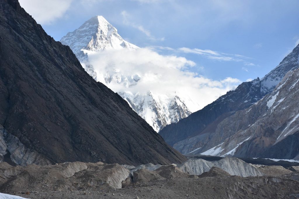
After visiting Concordia, K2, and Broad Peak, we followed the same itinerary back to Islamabad, via Askoli village, Shigar valley, and then to Skardu. We spent one night in Skardu before taking the spectacular flight back to Islamabad. The Skardu to Islamabad flight is weather-dependent, but we were very lucky. In case of bad weather, most tourists would drive on the Karakoram highway to Chilas or Naran for over overnight stay, then drive to Islamabad the next morning. Our K2 base camp trek adventure in Pakistan was concluded here; our guide transferred our foreign clients to Islamabad airport for their onward flight back to the United Kingdom.
I hope my “K2 base camp trek summary” excites you to take your next step towards this mighty Mountain.
Technicality of the K2 base camp trek in Pakistan.
After visiting Concordia, K2, and Broad Peak, we followed the same itinerary back to Islamabad via Askoli, shigar and Skardu. We spent one night in Skardu before taking the mountain view flight back to Islamabad. The Skardu to Islamabad flight is weather-dependent, but we were lucky. If it’s bad weather, most tourists would drive on the Karakoram highway to Chilas or Naran for overnight stays and then continue to Islamabad the next morning.
Our K2 base camp trek holiday in Pakistan concluded in Islamabad, and we were transferred to Islamabad airport for an onward flight back to the United Kingdom.
I hope my “K2 base camp trek summary” excites you to take your next step towards this mighty Mountain.
The technicality of the K2 base camp trek in Pakistan
The K2 base camp trek is a challenging and physically demanding holiday. I highly recommend that everyone doing the K2 Trek must be used to multi-day hill walking, be able to cope with sustained walking on rough and loose terrain and have good fitness to enjoy their time on this trek. Previous walking and trekking experience in high altitudes is recommended for this trip. Most days involve 5 – 7 hours of walking plus plenty of rest stops. The K2 trek is demanding, but the rewards are spectacular.
K2 was discovered in 1856 by Col. T.G. Montgomerie of the survey of that time in India and was given the symbol because it was the second peak measured in the Karakoram range. K2 is also known as Mount Godwin-Austen for the first surveyor, Col. H.H. Godwin Austen, a 19th-century English geographer.

Comments